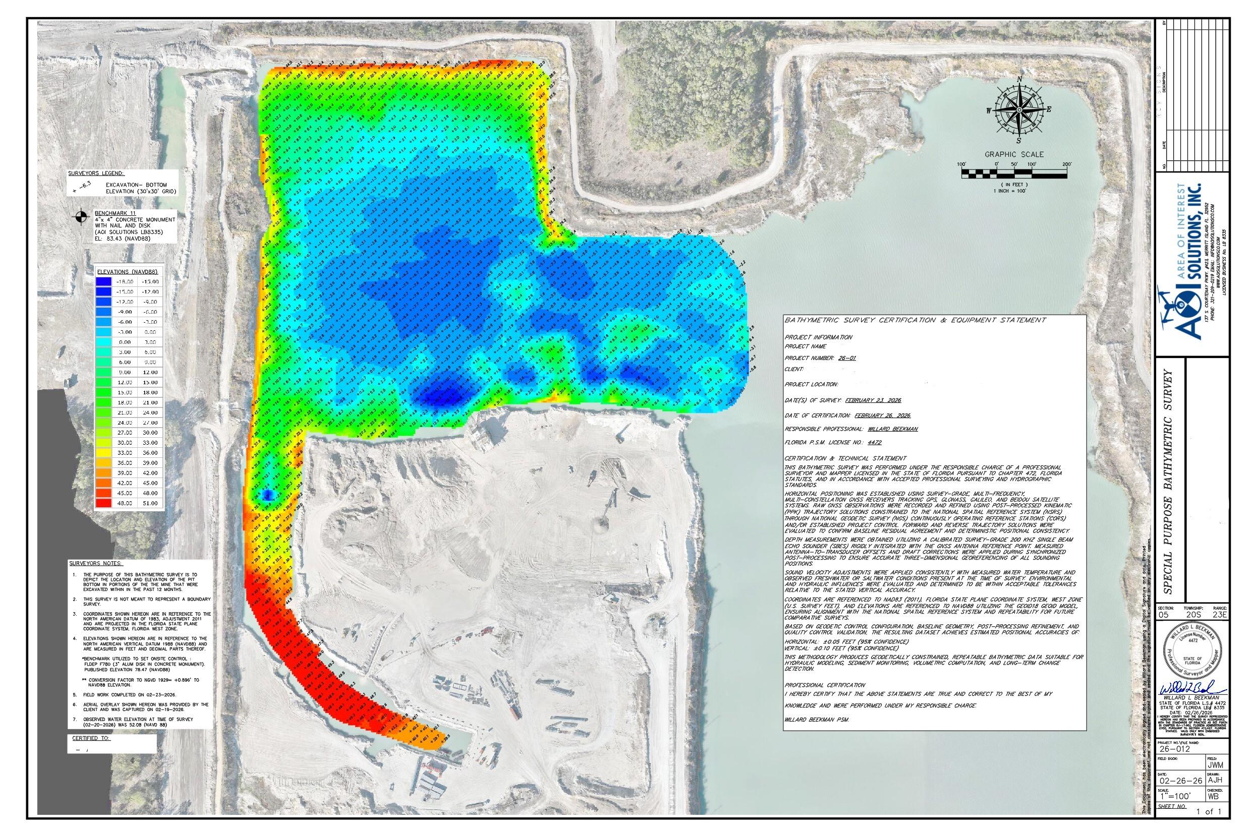
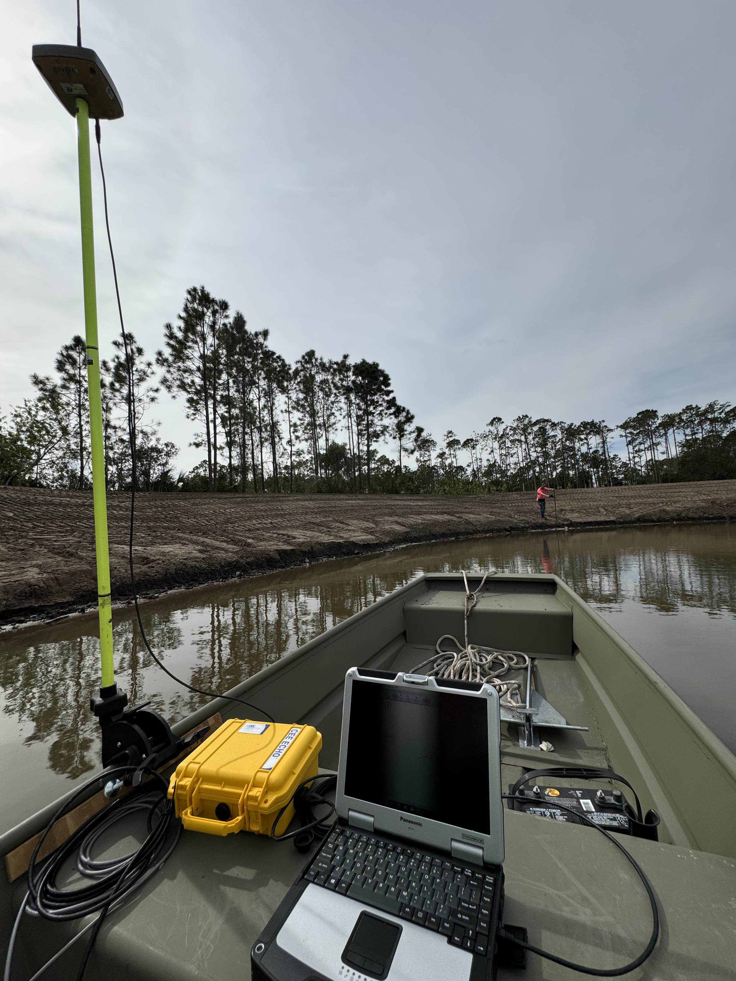
AOI Solutions provides precise underwater terrain mapping for lakes, ponds, rivers, retention basins, and other submerged environments throughout Florida.
Using advanced survey technology and geospatial workflows, we collect and process depth data that supports planning, maintenance, environmental analysis, storage calculations, and dredging decisions.
Bathymetric surveying reveals the actual shape and condition of the bottom so your team can make informed decisions about maintenance, storage, drainage, dredging, and long-term site performance.
The right data can help reduce uncertainty, support better planning, and give stakeholders a clearer picture of site conditions.