On paper, remote sensing sounds simple. You collect data from satellites, drones, or aircraft. You analyze it. You get clear answers.
But remote sensing in Florida doesn’t work that way.
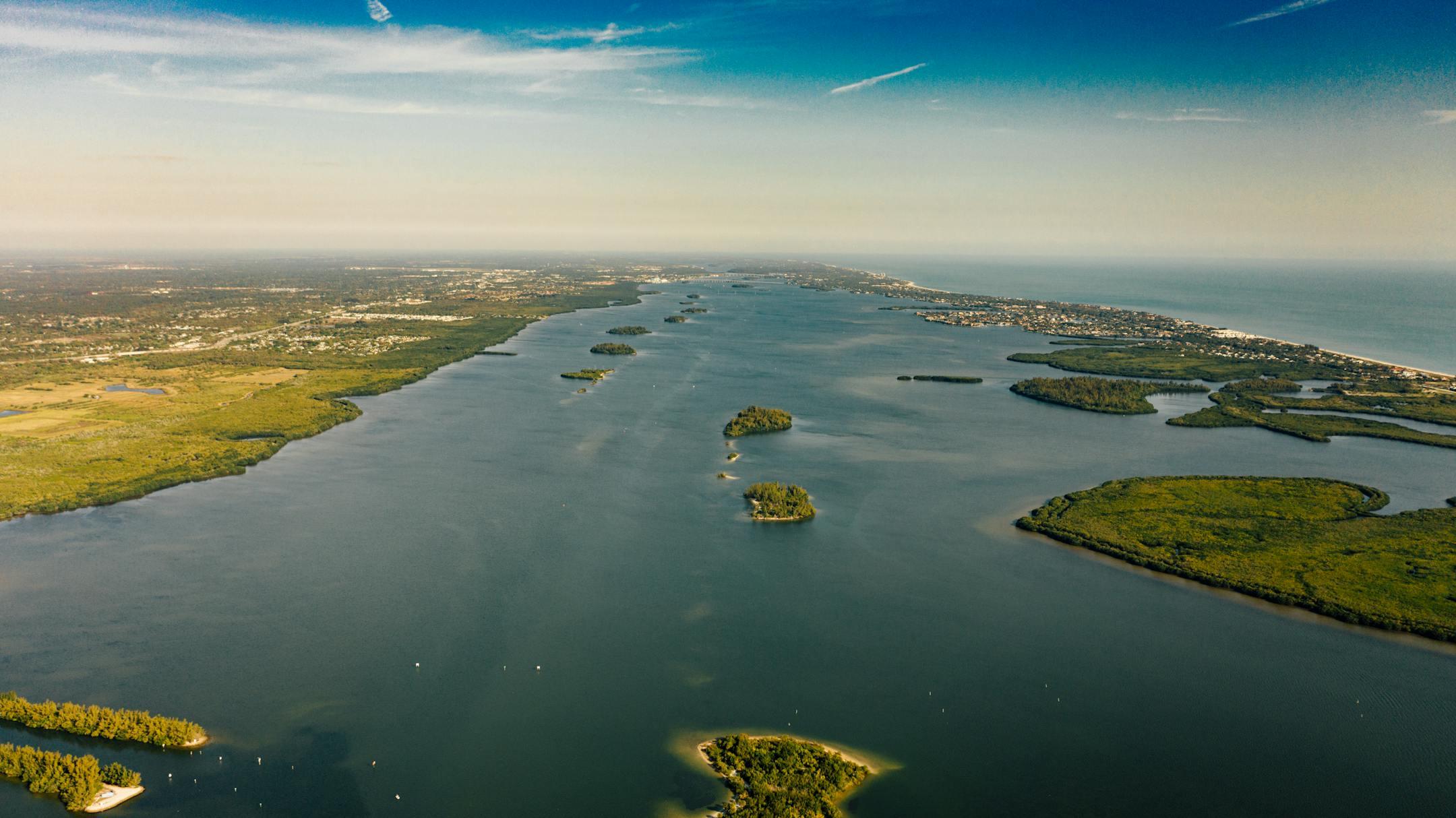
Florida looks easy from above. Flat terrain. Open land. Clear coastlines. But once you start working with real data, the challenges show up fast.
If you rely on remote sensing for planning, monitoring, or compliance, you need to understand what makes this environment different—and harder than it seems.
The weather doesn’t cooperate
Florida weather changes quickly. A clear morning can turn into a cloudy afternoon without warning.
That’s a problem for remote sensing.
Most satellite systems need clear skies. Clouds block visibility. Even light cloud cover can distort results.
In remote sensing in Florida, this leads to gaps in data, delayed timelines, and inconsistent imagery.
And it’s not just clouds. Humidity and haze reduce image quality. Afternoon storms interrupt scheduled flights and scans.
So instead of clean, predictable datasets, you often get incomplete coverage that needs extra work—or needs to be captured again.
Vegetation is dense and constant
Florida grows fast. Vegetation fills in quickly and stays active all year.
That creates another challenge.
Dense tree cover makes it hard to see the ground. This affects land use analysis, infrastructure mapping, and environmental monitoring.
Even with tools like LiDAR, you still need time and effort to filter through vegetation layers.
When remote sensing in Florida, you don’t just collect data. You spend time separating useful signals from visual noise.
And if vegetation changes between scans, comparisons become less reliable.
Water is everywhere—and it moves
Florida isn’t just land. It includes wetlands, lakes, rivers, and coastal areas.
And water doesn’t stay still.
Water levels change with rainfall, tides, storms, and seasons. That affects how data looks from above.
A flooded area one week can appear dry the next. Shorelines shift. Wetlands expand and contract.
When remote sensing in Florida, timing is critical. If you capture data at the wrong moment, it doesn’t reflect actual conditions.
That makes repeat measurements harder and long-term tracking more complex.
Flat terrain creates its own problems
Flat land seems easier to map. In reality, it introduces a different kind of difficulty.
Florida’s low elevation means small changes matter. A few inches can impact drainage, flooding, and land use.
But small changes are harder to detect.
Remote sensing depends on contrast. When everything looks similar, it becomes harder to identify meaningful differences.
For remote sensing in Florida, you need higher precision to get useful insights. That often means higher-resolution data and more careful calibration.
Without that, important details get missed.
Soil and surface conditions vary widely
Florida soil isn’t consistent.
You’ll find sandy areas, organic soils, clay pockets, and mixed surfaces. Each one reflects light differently and reacts differently to moisture.
This affects how remote sensing data appears.
Two areas might look the same in an image but behave very differently on the ground.
For remote sensing in Florida, interpretation matters as much as collection. If you don’t understand local conditions, it’s easy to misread what the data shows.
Urban growth changes the landscape fast
Florida continues to grow. Development moves quickly.
That creates a moving target for remote sensing.
Data becomes outdated faster in areas with active construction. A site captured last month may already look different today.
You might be working with imagery that shows a construction site, while in reality it’s already a finished building.
In remote sensing in Florida, timing matters beyond weather. It includes development cycles.
Accurate decisions depend on up-to-date data.
Regulations add another layer
Florida has strict environmental and land-use rules.
Many projects rely on remote sensing data to define wetlands, monitor protected areas, and support permitting.
But the standards are strict.
Your data needs to be accurate, consistent, and easy to verify.
Remote sensing in Florida isn’t just collecting data for insight. You’re collecting data that needs to stand up to review.
Mistakes don’t just slow things down. They can stop a project.
Data processing takes more work
Collecting data is only part of the job. Processing it takes time.
And in Florida, it usually takes more time than expected.
You’re dealing with cloud interference, vegetation filtering, water variability, and surface differences. Each factor adds complexity.
When it comes to remote sensing in Florida, raw data rarely tells the full story. It needs cleaning, correction, and validation.
That means more steps, more checks, and more attention to detail.
Skipping this leads to unreliable results.
Experience makes the difference
The tools for remote sensing are widely available. But using them well in Florida takes experience.
You need to know when to collect data, which sensors to use, and how to adjust for local conditions.
You also need to know how to interpret what you’re seeing.
In remote sensing in Florida, small mistakes create big problems.
The difference between useful data and misleading data often comes down to how the work is done.
Why this matters for your project
If your project depends on remote sensing, you need realistic expectations.
Florida adds complexity at every step. Data collection takes longer. Processing is more detailed. Interpretation requires local knowledge.
Ignoring these factors leads to delays, errors, and extra costs.
But when handled correctly, remote sensing still delivers strong results. It just requires the right approach.
Work with a team that understands the details
Remote sensing in Florida isn’t simple, but it’s manageable with the right team.
AOI Solutions Co. works through these challenges every day. They focus on accurate data, careful processing, and clear results you can use.
If you want reliable outcomes from your remote sensing in Florida project, contact AOI Solutions Co. to get started.